Update
Status: The 2024 SIWO season began on Friday, 29 March. Follow us on Facebook at https://www.facebook.com/seaiceforwalrus for more discussion.
The Sea Ice for Walrus Outlook (SIWO) is a resource for Alaska Native subsistence hunters, coastal communities, and others interested in sea ice and walrus. The SIWO provides weekly reports during the spring sea-ice season with information on weather and sea-ice conditions relevant to walrus in the northern Bering Sea and southern Chukchi Sea regions of Alaska.
The Outlooks are produced with information on weather and sea-ice conditions provided by the National Weather Service - Alaska Region and Alaska Native sea-ice experts. SIWO is managed by the Arctic Research Consortium of the US (ARCUS), in partnership with the Eskimo Walrus Commission, the National Weather Service, the University of Alaska Fairbanks, and local observers. Funding for SIWO is provided to ARCUS by the National Science Foundation's Division of Arctic Sciences (PLR-1928794). During 2020–2021, SIWO received support from Alaska Sea Grant for a formal evaluation, which is being led by University of Alaska Fairbanks. Results of the evaluation will be shared publicly when available.
Sea Ice for Walrus Outlook This Week
Assessment of Current Ice Conditions Relevant to Distribution and Access of Walrus
Click the name of each community below to view more frequently updated and detailed information from the National Weather Service.
Synopsis: Low pressure lingers over the Bering Sea through Monday, when it begins to move towards the Gulf of Alaska. Tuesday we will see high pressure begin to build in the area with a chance for low pressure to move across the ridge Wednesday night. However, the overall pattern will be influenced by the high pressure that builds into the area Tuesday.
Near St. Lawrence Island
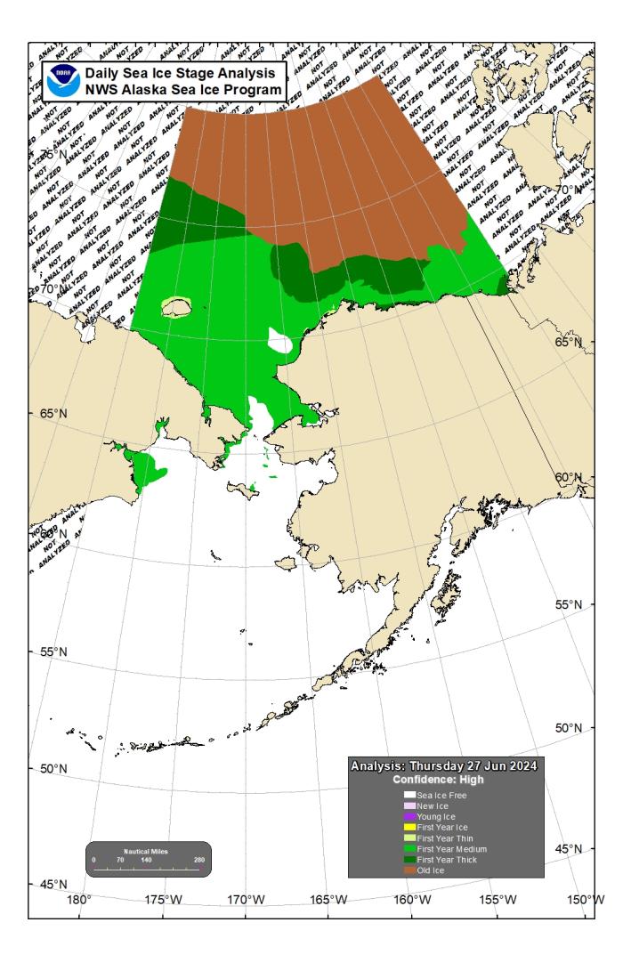
The only ice remaining around the island is between Camp Iveetok and Camp Kulowiye. There is close pack ice between those features extending up to 2 miles (3.2 km) offshore near those endpoints. However, a large narrow corridor of pack ice extends up to 75 miles (120 km) to the northeast. The remaining ice looks to be brash ice to small floes and is melting quickly. It will likely be gone in another week to 10 days.
Nome
Norton Sound is ice free for the season.
Nome port entrance webcam (via AOOS webpage): https://bering-sea.portal.aoos.org/?ls=79875242-e362-65cb-914e-fed20ff9…
Brevig Mission/Port Clarence Area
Port Clarence/Brevig Mission is sea ice free for the season.
Wales to Shishmaref
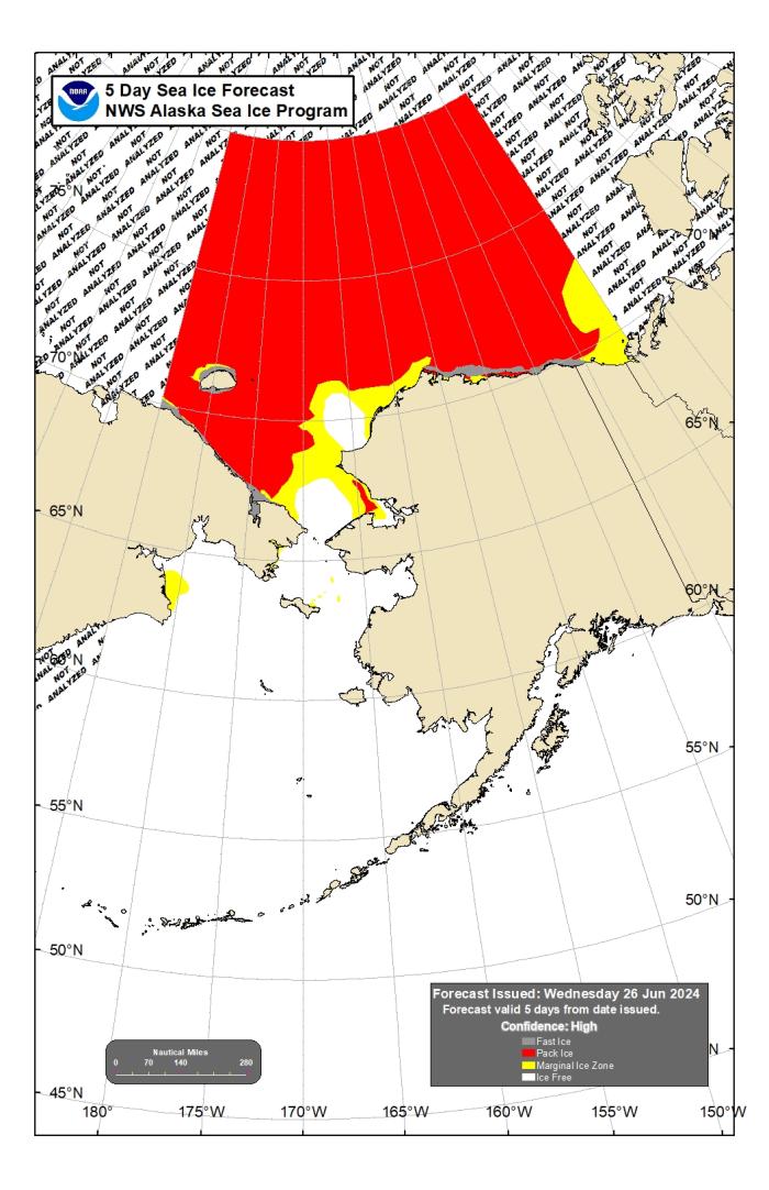
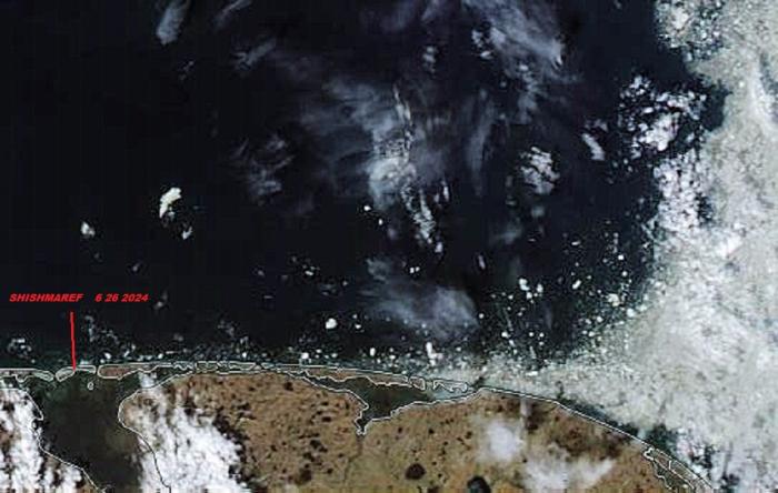
Ice-free water extends from Wales to Ikpek. Between Ikpek and Shishmaref is an area of very open pack ice with anywhere from ice cakes to brash ice. To the northeast of Shishmaref is very open pack ice with a few small to medium floes up to 20 miles (32 km). The remaining pack ice is near Espenberg and northward toward Kivalina.
Diomede
Diomede is sea ice free for the season.
Forecast Discussion
Ice Forecast
The remaining open pack ice near Shishmaref will melt this week, and remaining pack ice between Espenberg and Kivalina will quickly decrease in concentration as a warmer air mass moves overhead. Ice-free conditions will likely exist within a week.
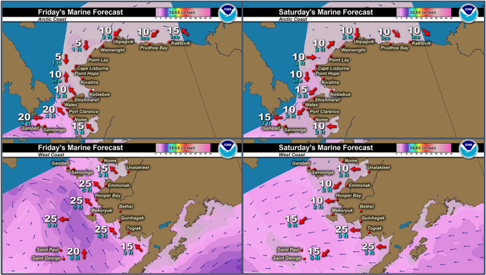
Wind Synopsis
Today (Thursday, 27 June) we will see variable winds at 5 to 10 knots as a surface low moves across the area. Tonight will see winds strengthen and turn northerly with winds at 10 to 15 knots. Tomorrow (June 28) will have southerly winds at 10 to 15 knots turn southerly briefly overnight at 5 to 10 knots. Saturday (June 29) will have persistent northeasterly winds at 10 knots. Sunday (June 30) the winds shift to the northwest at 10 to 15 knots and remain westerly until Tuesday afternoon (July 2). Tuesday night we will see winds shift out of the south at 5 to 10 knots. Those should continue through Thursday (July 4).
Temperature Trend
We will see temperatures in the mid-50s today, then begin to cool into the mid 40s starting tomorrow and will persist through next Thursday. Low temperatures will be in the low to mid-30s throughout the week.
Daily Weather, Wind, and Temperature Updates
The National Weather Service provides twice-daily, text only updates on the weather, wind, and temperature conditions in specific geographical zones. An interactive weather map for access to other Alaskan zones can be found here: http://weather.gov/anchorage/ice
Higher resolution satellite images and wind maps (wind updated daily) can be viewed here: http://www.weather.gov/afg/SIWO_overview
The Alaska Ocean Observing System shares a variety of weather and sea ice related resources in their Bering Sea Portal at https://bering-sea.portal.aoos.org/.
Marine forecast for the West Coast and Arctic Coast
Remote Sensing Images
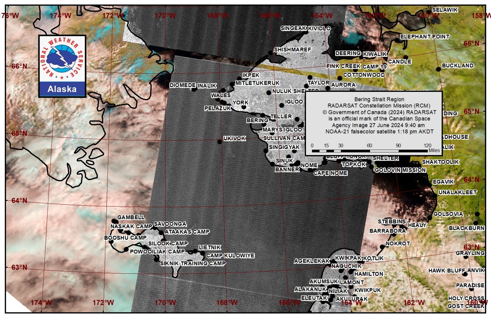
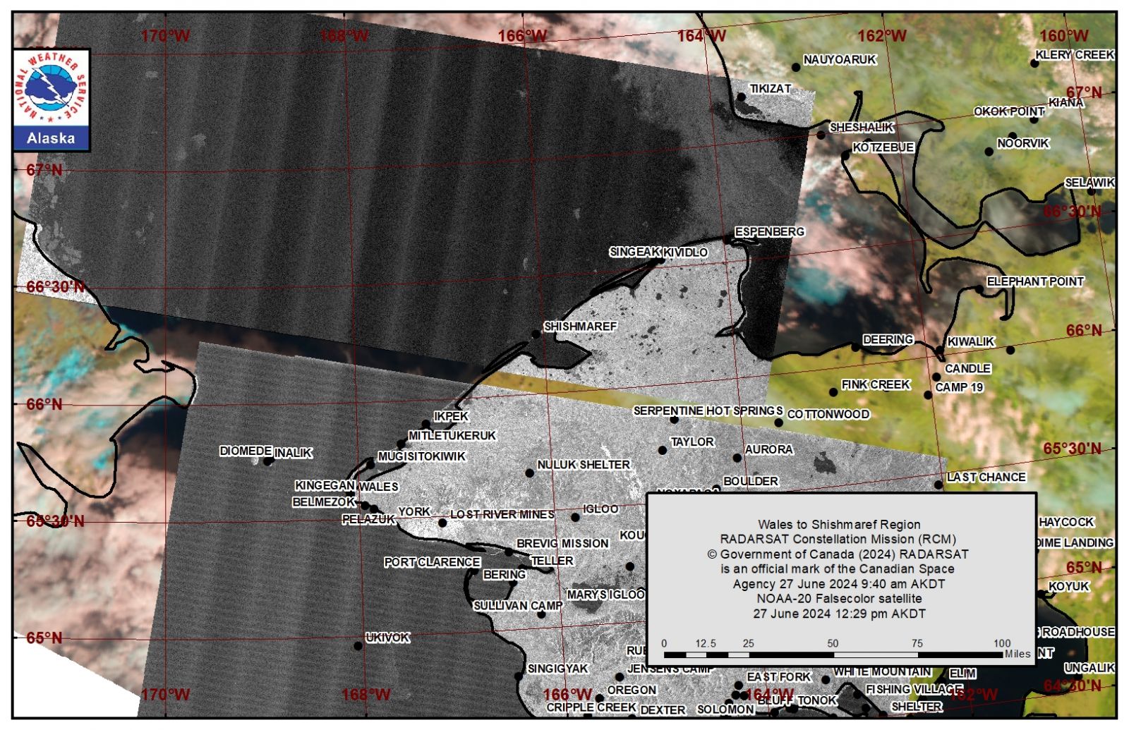
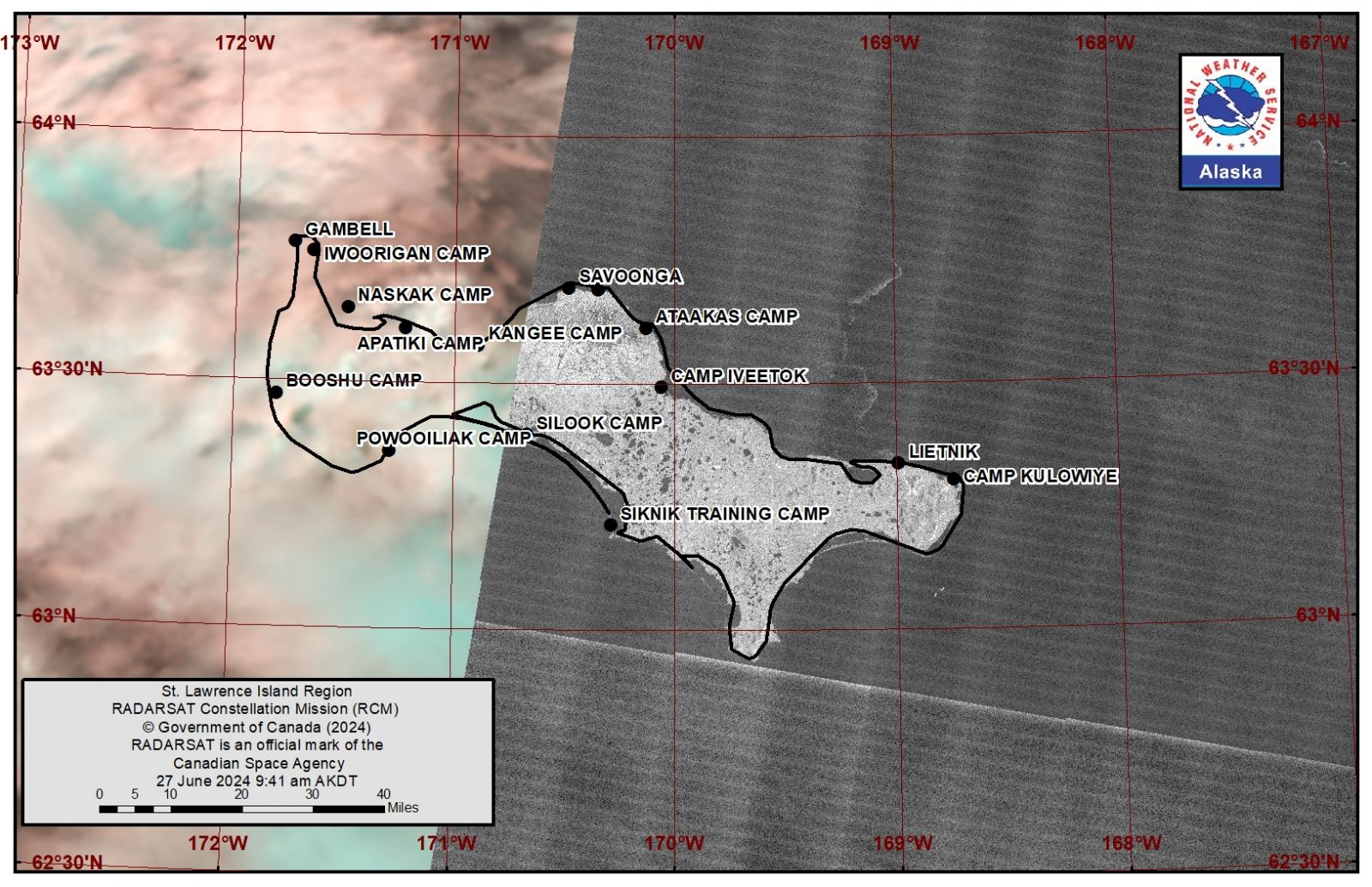
Observations and Comments
Observations of Sea Ice Development
Observations from Shishmaref
Thursday, 28 June 2024 – Curtis Nayokpuk
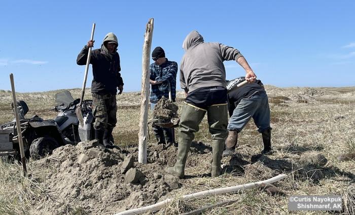
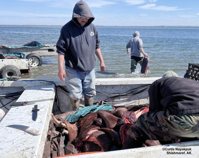
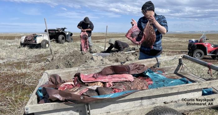
Final steps of spring subsistence food processing (buried treasure)! Past week was slow due to daily fog but hunters persisted with game few and far between as the last of packed sea ice moved east to Kotzebue Sound. Hunters out after Bearded Seal and Walrus this spring have been successful shown by drying racks full and now hopefully fishing will be as good.
Tuesday, 25 June 2024 – Corey Ningeulook
There are boats still hunting oogruks, walrus from shishmaref. Ice is still out in the ocean in front of town.
Observations from Plane
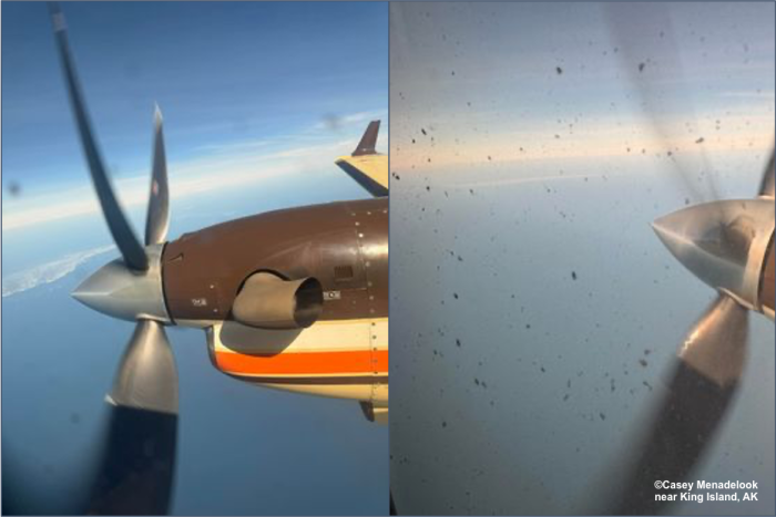
Thursday, 28 June 2024 – Casey Menadelook
There’s some ice just south of King Island as of yesterday.
Additional Comments Provided by Local Experts and Other Contributors
Shared by the Alaska Ocean Observing System (AOOS) for 26 June–4 July 2024
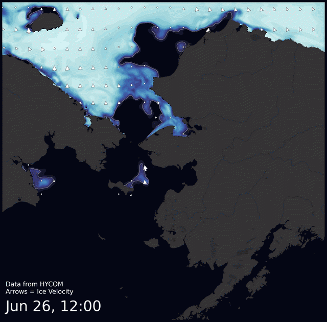
Click the image below to view this animation showing the predicted movement of ice predicted by the HYbrid Coordinate Ocean Model (HYCOM). Snapshots from the forecast show ice coverage from 0% (black) to 100% (white) and arrows show the relative speed and direction of the ice. A light boundary is drawn at 15% predicted ice cover to highlight the ice edge, but ice may be predicted to extend beyond it. Some bays, lagoons, and areas very close to shore are not covered by the model. (Image produced by the Alaska Ocean Observing System / Axiom Data Science).


